High resolution landscape analysis
Development of a new method of landscape analysis adapted to high-resolution LiDAR digital elevation model (DEM) using a 2D hydraulic model
Context
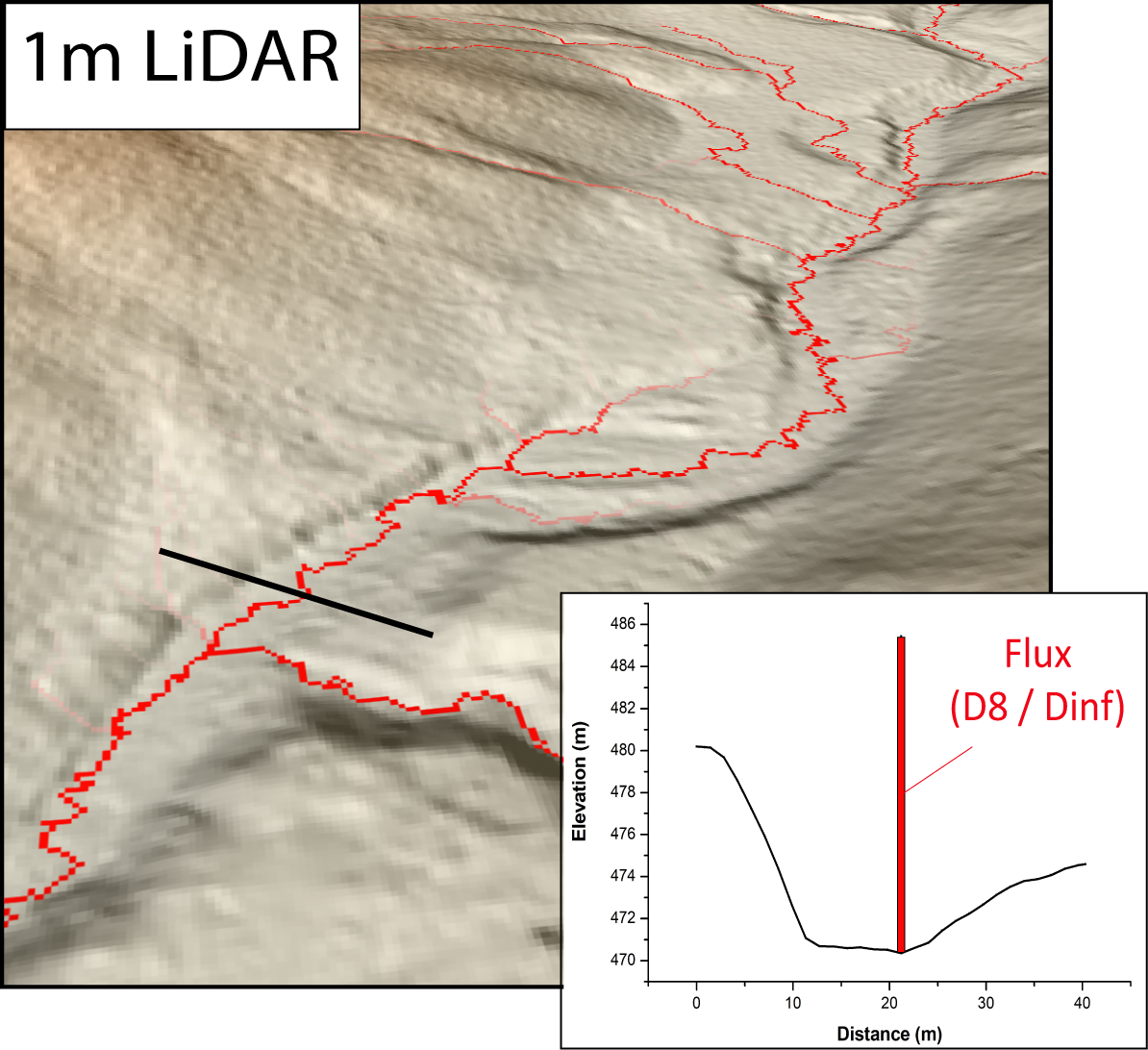
The channel network has long been studied as an active marker of spatial variations in tectonic uplift rates. River profiles are also analysed to uncover past tectonic or climatic perturbations. High Resolution LiDAR digital elevation model (HRDEM, <2m) offer an unprecedented level of vertical accuracy (< 20 cm) and channel resolving ability that coarse DEM (>30 m) cannot offer. This increased resolution and precision is expected to yield better detection of subtle topographic signals and identification of catchment domains. But it also requires new methods to address the significant change in resolution. Such methods have been developed the last years but all use 1D flow routing that are not consistent with HRDEM analysis of channels wider than several pixels. Here, we apply the 2D hydraulic model Floodos, based on the 2d shallow water approximation, at catchment scale to revisit and go beyond the traditional set of tools developed for coarse DEM analysis.
Project Results
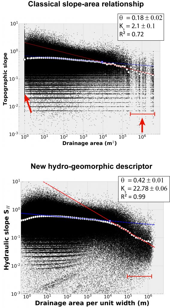
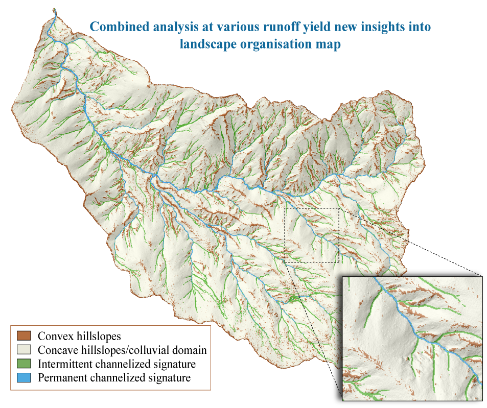
2D hydraulic model analysis have several benefits over the classical landscape analysis methods. It allows to directly account for channel width in the calculation of fluvial hydraulic variables (unit discharge, hydraulic slope, shear stress, etc.). For instance, this has been used to develop a new hydro-geomorphic descriptor based on the classical slope-area (S-A) relationship. This new descriptor uses the hydraulic slope and a drainage area per unit width (from unit discharge) which allows to go beyond the S-A analysis. Here are some advantages:
- A richer description of landscape organization for various runoff intensitie
- A shaper transition between colluvial and channelized domain
- A much clearer expression of the concavity and steepness index than the traditional slope-area analysis
- Reduced the sensitivity to DEM resolution
Find out more
Bernard, T. G., Davy, P., & Lague, D. (2022). Hydro‐geomorphic metrics for high resolution fluvial landscape analysis. Journal of Geophysical Research: Earth Surface, e2021JF006535.
Contact